Monday, September 6, 2010

Off to Switzerland (August 30th - September 6th)

Roy, Simon and I had talked about a long trip for us sometime this summer but August found Roy with family plans and it just did not work out.  Then a plan developed to travel to Italy down the coast, cross the shoe and up the other into Austria.  Twenty days of travel would be needed.  Roy could leave on August 30th but this left me with too few days left before I had to return to the states so we made a compromise.

I would meet them at a camp site in the Loire valley on the first night where they would come from Normandy and I would travel south from Paris.  From there we would all three travel to Chamonix the next day.  Then from a point in Martigny we would split up where I would head to the Interlaken area in Switzerland and they would continue on for their 18 day trip through Italy.  I had been wanting to finish the year with a trip to Switzerland and this was the opportunity.

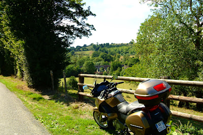
Camping was the order of the day to conserve expenditures.  We had grown used to this and it was not really a hardship.   I arrived first and had virtually the entire camp to select a campsite.  Here is my fully loaded bike just after I arrived.  The bike can easily carry all I need for a week or a month in the field. 


Roy and Simon arrived around 6 pm.  Here we all are in our first camp in Cosne-Cour-s-Loire.


Meals were simple.  We had canned meals which we heated up on our small burners.


Here we all are getting our burners ready to heat the meals.  Someone singed their eyebrows in a little incident which luckily we can joke about.  Roy and Simon are still on the road in Italy so I will let one of them tell that story when they get back.

The next morning, we drove east and stopped at Annecy which is a beautiful French town right along side a large mountain lake. 


Here we stopped to take a picture of the lake.


Luckily, we headed out in the morning deciding to stay on auto-route and N roads to shorten the time we would be on the road.  By the time we got to Annecy it was afternoon and we still had several hours of very technical driving through winding mountain roads and passes.  As it happened, it was not till around 6:00pm that we found our campsite a few miles from Chamonix.


Again, a campsite was chosen and this time it was in a deep valley. 


Simon had a friend that lived a kilometer from the camp site and here we all are in her back yard over looking the camp site.

It got chilly that night and the next morning when we headed out I spotted a thermometer in a small town that said 8 degrees C. which is about 46 degrees F.  With our riding gear on the only thing that got a little cool was our hands.  We had brought summer leather gloves and we should have also brought our winter ones as well. 

After a few hours on the road we stopped for a coffee.  I decided I wanted a patisserie too so we all got one.


Very good but that coffee stop cost us 30 Euro.  Very expensive when you don’t stay on budget.  But it was sooo good.


Here we are getting close to the point where we split up.  Roy and Simon had come with me part way into Switzerland because they wanted to avoid the super long and boring tunnel at Chamonix that leads them into Italy.  Coming with me this way put them over into Italy on one of the most beautiful passes in the area. 


A close up of the valley.  This is Martigny and our paths will divide at the first round-about in town.  I head off further into Switzerland.  I figure it will take me 4 or 5 hours to get to my destination which would be the Interlaken area. 


I said good by to them and they headed off.  I stopped along the way for this picture.

Here I stopped on route for a quick picture of the beautiful landscape.  Everywhere you turn in Switzerland is a picture perfect moment.

A little further on two girls on a Honda CBT600 stopped by the road and were taking pictures of each other.  I stopped to offer a shot of both of them.  They then took this of me.  Hey – I was going to stop anyway. 


Bad light on me but background is good.


Hmm.  What happened to the road?
 

I reached Interlaken and set up camp along the lake.  Here was my view from the tent.

As this was my third day in the field, I had one more full day before I needed to return to Paris.  The trip home would take another two days.  I decided to spend that day touring around the Lauterbrunnen Valley and Grindelwald.  Both of these destinations were only about 20 miles from camp but with all the neat small roads to explore this took me the entire day. 


Here are some shots from that day’s travel.  A water fall, one of dozens cascading down the cliffs is seen here at the edge of town.


I reached a mountain pass where I could go no further so decided to treat myself to lunch at the restaurant located at the top of the mountain.  As I set at the table I took some pictures of the area surrounding me.


Lunch was a cheese fondue which you dipped bits of bread and potatoes in – a local Swiss treat. Delicious and filling.

I headed back out down the mountain road and decided to take a very small one-lane road back up in another direction.  Each hair pin turn seemed like it went up 45 degrees.  Very tight turns and lots of attention to driving was needed.  On one of the few flatter areas, I stopped to rest and took another pic.


A look back down the road I just came up.


I finally came to a tunnel entrance that continued as a one lane road through it.  I was questioning my sanity at this point as I had no idea how long the tunnel was or what you did if you met on-coming traffic.


There were very few lights in the tunnel (about 1 in every 100 meters) and it looked more like a mining tunnel once you proceeded in to it.  Every ¼ mile there was a y-junction that if you followed it you wound up on the side of the mountain where the road ended into a hiking path. The tunnel turned out to be about a mile long and very creepy once inside.  There were no road markings of any kind.  I did see lights twice and found myself facing on-coming traffic.  I pulled over and we passed safely but not easily.

So, at the end of the day I headed back to camp.  My Swiss trip was coming to an end.  The ride back into Eastern France, the next day was also a planned part of the trip as the roads and views were spectacular.  I drove west along the northern edge of the lakes but since I was making good time and heading home I just kept on moving with no pictures from that day. 

I spent the next night at Besançon in an ETAP hotel.  I needed a good bath and a good bed for a night so I treated myself.  Then, the next day, it was just hitting the auto-route back to Paris where I arrived about 1:00 pm today.

So, that is my last trip for this year.  I have traveled over 14,000 km this summer and it has been great fun.  Still, I have not seen even ½ of France so lots to do when I come back.

I clean the bike up tomorrow and park it for the winter.  I will pick up the travel again next year when I return.

Monday, August 23, 2010

Grand-Camp Maisy – Swiss Normandy and a Great Birthday Party

August 20 - 21, 2010

I was invited to Simon’s 40th birthday party in Normandy last weekend (August 21st) so I decided to go a few days ahead of time and play around a bit.  Grand-Camp Maisy is a port town that I had not seen before and I had heard that there was recently discovered a secret buried German encampment.  In addition, I have been wanting to get back to Swiss Normandy for a few months but had not the opportunity.  This trip, while short, presented an opportunity to combine all of them within a four day time period. 

On the way over I stopped to take a picture of a carnival poster in a small village.


Seen in many locations on the back roads of France are road side crosses and symbolisms of Christianity, most notably are these monuments that are seen on the corners of roads so out of the way that only local residents see them.  Here is the detail from a cross that stands 30 feet in the air found at a cross road.


Sometimes I bring a picnic lunch on my trips.  Here is a location where I ate lunch on Saturday.


Grand-Camp Maisy (August 20th, 2010)

There is a new find in Grand-Camp Maisy that redefines the history of Normandy that you won’t find in any current history books.  For three days, big guns opened fire on the landing ships as D-day arrived in Normandy for Omaha and Utah landing beaches.  A German map shows that there were no big guns at Pointe du Hoc where the Rangers landed however, on June 6th the Germans still had complete coverage of the landing beaches.  The guns that attacked these beaches were at Grand-Camp- Maisy a German base that was so well hidden no one new about it on D-day.  Maisy was buried immediately after the war and forgotten.   The entire area has been reverted to farm land ever since.   A local was walking the field one day and tripped over a pipe low in the ground.  Digging down, he found that it was a ventilation pipe leading into a concrete bunker.  Intrigued, he started talking to older residents of the area and learned that there was heavy German activity in this area but no locals were allowed near the site.  He went to the US and researched it further and found that there were American records from the war reporting it’s discovery.  In order to fully unearth this area, he had to buy property from some 20 different residents which took several years.  Finally, owning the property he began digging and found one of the largest underground German bunker systems known in WWII.  There were soldier barracks, officer barracks, a communications building, a hospital, emplacements for 155 mm howitzers and many other buildings all buried and well hidden.  All of the equipment from these bunkers was removed when discovered in 1944 so only the buildings remain.  This site was officially opened to the public in 2006 but there is still much work to do in uncovering the remaining buildings.  Even today, as you look in the direction of the find, all you see is grass land.  You do not see the bunkers until you start walking the trenches that were created in the discovery process – the trenches are in the same location as they were in WWII.


Trenches were used to traverse from one location to another in this complex.


A German living quarters for soldiers.


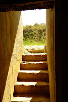
Steps leading down into living quarters.  Visitors are free to enter any of the bunkers and explore by themselves.


Below is where one of the 155 mm howitzers used to sit.
 

The Fish Market…

As I had set my GPS to the center of town, one of the first things I saw as I entered the town about 10:30 am was the harbor and the fish market which was in full swing with locals buying fresh fish and sea food from early morning catches. 


An assortment of fresh fish.


Lobsters and sea snails (bulots).


No clue what these fish are.


Before I went to the Bunker site, I ate Moules-Frites (muscles and fries) with a Coke at the harbor restaurant.  They were very tasty. 

And, the Coke they serve in France is made from real sugar like it was in the 1980’s before they changed the formula.  Remember that – New Coke?  Then three months later they said they reverted back to the original formula but they lied.  They had used real sugar in the original formula but after New Coke fizzled when the reverted back to Coke original they replaced the sugar with corn sweetener and it never tasted like the ‘Real thing’ again.  Well, it is still the ‘Real Thing’ in France and you don’t know how good it is till you tried it.  Things really did taste better in the ‘olden’ days.


Swiss Normandy (August 21st)

Not many people know that Normandy has a section where there are lots of hills and dales called Swiss Normandy.  While nothing like the Alps, it is still a restful and beautiful area to visit on a bike.   I have been there several times and always love going back.  Driving time from Paris is about 2.5 hours by auto-route or about 4 hours if you travel the back roads. 


The roads in Swiss Normandy tend to be narrow and run through picturesque country.  


The French do not spray herbicides on the plants at the side of the road leaving ugly brown dead plants like they do in the US.  Instead, when they become obtrusive, they use a large device to cut the branches way from the road.  This leaves a beautiful path through the foliage that often joins above to make these closed and covered woodland roads.


The villages tend to be small sometimes consisting of only a few stone houses. 


Here is an old farm house that no one lives in.  These dot the landscape.  Build in the 1700 or 1800s many are still structurally sound and could be made livable again.  


The woods are lovely dark and deep and I have miles to go before I sleep.  


Up the hill I went on this road.  Great views all around.


There are stone cliffs throughout Swiss Normandy with fast moving and cold streams that are frequently used by canoeist and kayakers. 


Here some rock climbers test their mettle.


Many small monuments are located in Normandy dedicated to the American soldier.  Here is one at a cross road.  Note at the bottom it shows the name of the town that created the memorial - and in the next picture the road sign pointing to that village.

Historical note: (The 368th fighter group - established as a B-17 Flying Fortress heavy bomb group in early 1942. Trained under Second Air Force before deploying to England in September 1942, becoming one of the first heavy bomber squadrons of the VIII Bomber Command 1st Bombardment Division. Highly decorated squadron during Air Offensive over Nazi Germany and occupied Europe.)

This small town had only a few houses so you can see the significance given to the American soldier by these small villages.


Finally, a picture of me as I take a few minutes rest.