Monday, August 23, 2010

Grand-Camp Maisy – Swiss Normandy and a Great Birthday Party

August 20 - 21, 2010

I was invited to Simon’s 40th birthday party in Normandy last weekend (August 21st) so I decided to go a few days ahead of time and play around a bit.  Grand-Camp Maisy is a port town that I had not seen before and I had heard that there was recently discovered a secret buried German encampment.  In addition, I have been wanting to get back to Swiss Normandy for a few months but had not the opportunity.  This trip, while short, presented an opportunity to combine all of them within a four day time period. 

On the way over I stopped to take a picture of a carnival poster in a small village.


Seen in many locations on the back roads of France are road side crosses and symbolisms of Christianity, most notably are these monuments that are seen on the corners of roads so out of the way that only local residents see them.  Here is the detail from a cross that stands 30 feet in the air found at a cross road.


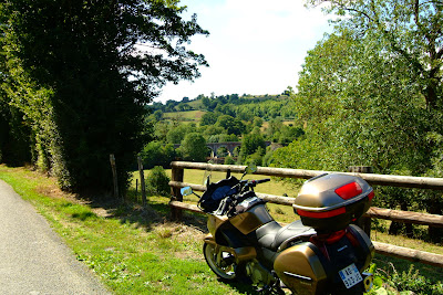
Sometimes I bring a picnic lunch on my trips.  Here is a location where I ate lunch on Saturday.


Grand-Camp Maisy (August 20th, 2010)

There is a new find in Grand-Camp Maisy that redefines the history of Normandy that you won’t find in any current history books.  For three days, big guns opened fire on the landing ships as D-day arrived in Normandy for Omaha and Utah landing beaches.  A German map shows that there were no big guns at Pointe du Hoc where the Rangers landed however, on June 6th the Germans still had complete coverage of the landing beaches.  The guns that attacked these beaches were at Grand-Camp- Maisy a German base that was so well hidden no one new about it on D-day.  Maisy was buried immediately after the war and forgotten.   The entire area has been reverted to farm land ever since.   A local was walking the field one day and tripped over a pipe low in the ground.  Digging down, he found that it was a ventilation pipe leading into a concrete bunker.  Intrigued, he started talking to older residents of the area and learned that there was heavy German activity in this area but no locals were allowed near the site.  He went to the US and researched it further and found that there were American records from the war reporting it’s discovery.  In order to fully unearth this area, he had to buy property from some 20 different residents which took several years.  Finally, owning the property he began digging and found one of the largest underground German bunker systems known in WWII.  There were soldier barracks, officer barracks, a communications building, a hospital, emplacements for 155 mm howitzers and many other buildings all buried and well hidden.  All of the equipment from these bunkers was removed when discovered in 1944 so only the buildings remain.  This site was officially opened to the public in 2006 but there is still much work to do in uncovering the remaining buildings.  Even today, as you look in the direction of the find, all you see is grass land.  You do not see the bunkers until you start walking the trenches that were created in the discovery process – the trenches are in the same location as they were in WWII.


Trenches were used to traverse from one location to another in this complex.


A German living quarters for soldiers.


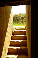
Steps leading down into living quarters.  Visitors are free to enter any of the bunkers and explore by themselves.


Below is where one of the 155 mm howitzers used to sit.
 

The Fish Market…

As I had set my GPS to the center of town, one of the first things I saw as I entered the town about 10:30 am was the harbor and the fish market which was in full swing with locals buying fresh fish and sea food from early morning catches. 


An assortment of fresh fish.


Lobsters and sea snails (bulots).


No clue what these fish are.


Before I went to the Bunker site, I ate Moules-Frites (muscles and fries) with a Coke at the harbor restaurant.  They were very tasty. 

And, the Coke they serve in France is made from real sugar like it was in the 1980’s before they changed the formula.  Remember that – New Coke?  Then three months later they said they reverted back to the original formula but they lied.  They had used real sugar in the original formula but after New Coke fizzled when the reverted back to Coke original they replaced the sugar with corn sweetener and it never tasted like the ‘Real thing’ again.  Well, it is still the ‘Real Thing’ in France and you don’t know how good it is till you tried it.  Things really did taste better in the ‘olden’ days.


Swiss Normandy (August 21st)

Not many people know that Normandy has a section where there are lots of hills and dales called Swiss Normandy.  While nothing like the Alps, it is still a restful and beautiful area to visit on a bike.   I have been there several times and always love going back.  Driving time from Paris is about 2.5 hours by auto-route or about 4 hours if you travel the back roads. 


The roads in Swiss Normandy tend to be narrow and run through picturesque country.  


The French do not spray herbicides on the plants at the side of the road leaving ugly brown dead plants like they do in the US.  Instead, when they become obtrusive, they use a large device to cut the branches way from the road.  This leaves a beautiful path through the foliage that often joins above to make these closed and covered woodland roads.


The villages tend to be small sometimes consisting of only a few stone houses. 


Here is an old farm house that no one lives in.  These dot the landscape.  Build in the 1700 or 1800s many are still structurally sound and could be made livable again.  


The woods are lovely dark and deep and I have miles to go before I sleep.  


Up the hill I went on this road.  Great views all around.


There are stone cliffs throughout Swiss Normandy with fast moving and cold streams that are frequently used by canoeist and kayakers. 


Here some rock climbers test their mettle.


Many small monuments are located in Normandy dedicated to the American soldier.  Here is one at a cross road.  Note at the bottom it shows the name of the town that created the memorial - and in the next picture the road sign pointing to that village.

Historical note: (The 368th fighter group - established as a B-17 Flying Fortress heavy bomb group in early 1942. Trained under Second Air Force before deploying to England in September 1942, becoming one of the first heavy bomber squadrons of the VIII Bomber Command 1st Bombardment Division. Highly decorated squadron during Air Offensive over Nazi Germany and occupied Europe.)

This small town had only a few houses so you can see the significance given to the American soldier by these small villages.


Finally, a picture of me as I take a few minutes rest.


Simon’s Party (August 21st – later that night)

The main reason I made the trip was to attend a friend’s 40th birthday.  Simon is a Brit that moved to France with his family and we all like to get together from time to time to do ride-outs into the Normandy country side. 

Simon and his wife spent a lot of prep work in setting up for the party and many friends and local Normandy residents attended the party.  The French people in Normandy have a very friendly relationship to Americans and Brits since they were liberated from German occupation in WWII.  American and British flags fly every where in Normandy right along side the French flag and we are made to feel very welcome.


There was a lot of food but the lamb was prepared by an expert local to the community.


Here it is on the spit.


The band was excellent and played all night.


Here is Simon greeting some of the guests.  The traditional French greeting is customary for all.

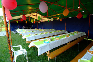
Here is a picture of almost the entire group gathered at the tables.  I left around 1:00 am and things were just getting started.  I had not driven my NT700 in the dark before and I had 17 miles to go on narrow, very dark back roads to my hotel.  It was eary but exhilarating.


Simon has two sons and a daughter and while Archy and Conor were out playing with the rest of the kids, Emily was the belle of the ball.  She was having a good time and never fell asleep.


So, that was an excellent three day trip spent in Normandy and I encourage all to visit France one day and enjoy the sites and friendship in the Normandy area.

Sunday, August 8, 2010

10-Day Trip down the West Coast of France & into Pyrenees Mountains

The Plan:

I had been considering this trip for a few months.  I wanted to do a trip down the west coast of France and I also wanted to do a trip into the Pyrenees mountains.  After considering both I decided to combine them into one long loop starting and ending at my apartment in Paris.

At the end of this trip when I returned to Paris I had hit a milestone.  I had traveled over 10,000 kilometers since mid April on the Honda NT700.  It has not seemed that I have traveled that far but I guess the odometer does not lie.  Actually, I have not gotten to half the places I want to see yet and barely explored 1/4 of France so there is lots to do in the future. 

Paris to Flers (26 July):

This is the part I always hate about a trip.  After I decide I want to go, the ‘getting out of town’ part is hard for me.  I want to be into the trip already and the first day I always find myself driving through familiar territory so it is not much like a trip yet to me.  After the second day I am ok.  Don’t get me wrong, Paris to Flers is a nice trip on the D-roads after I get to Dreux using N12 but I have done this a dozen times before so I have to get past this to feel like I am off on a new trip.  After Dreux, I head west on D-926 though Aigle and on to Argentan.  From there I take D-924 to Flers.

When I set the GPS, I usually set short hops and tell it to use the ‘shortest distance’ instead of the ‘fastest trip’.  This keeps me on the D-roads I want to travel but it gets kind of strange in towns and villages.  I wind up on the weirdest short cuts through towns and see things you would not normally see on a road trip.  I wish there was a setting for ‘shortest distance except head straight through towns setting’ but there is not and I would start to just ignore the GPS directions in towns except for the fact that I have seen so many interesting things in towns I had originally just planned to zip through.  One really strange thing happened on this trip that you will not believe but I will save this for when I get there. 

Anyway, I did no stops or took any pictures on this leg and made it to the Flers ETAP hotel without issues.  I had previously did all my ETAP reservations on line and had no problems finding stops where I wanted them except for Biarritz where everything was full. This was not a problem, I just changed a loop and stayed in Pau which worked out better for me for the mountain part of this trip.

As for meals, I carry the makings for lunch on the bike which I refresh each day (eat in roadside parks) and buy what I call a ready-meal from the cooler section that I can heat up and eat in the hotel. 

I do this to contain travel costs and can average about 6 Euro a day for food.   I also average about 14 euro a day for fuel so total daily expenditures I can keep at around 20 Euro a day while on the road with ETAP hotels adding another 48 Euro.

Flers to Vannes (27 July):


Here right away things start getting interesting – and remember the ‘something strange’ earlier I mentioned – it happened on this day.  The first town I go through from Flers is Domfront. 

I traveled through the city wall and stopped to take a few pictures as I had not done this before even though I had visited the town before. 

Further on down the road, not sure of exact location I zipped past a small châteaux that was near the side of the road (don’t know what road I was on) and the chateaux was not remarkable except that there was a beautiful clearing across the road that had what looked like Roman statues in the garden.  I had gone about a mile and said to myself, sh*t, am I going to zip past everything or am I going to stop and take pictures which is one of the reasons I am taking this trip.  You know how when you get moving down the road that you just want to keep going.  Anyway, I stopped and went back and parked in front of the garden area and got my camera out. It felt good to get off the bike seat for a few minutes and I needed the rest stop. 

I was in the process of taking pictures when the châteaux owner and his wife came out and asked what I was doing.  He asked me ‘Why was I taking pictures?”.  I told him that I was doing it because the statues were unusual and beautiful.  He warmed up to me at that point and invited me back to the châteaux for a drink.  We chatted and he showed me more Roman ruins on his property as well as his restoration projects.


The family dog bounded up and dutifully dropped a yellow golf ball at my feet and we play ‘chase the ball’ for a few minutes while we walked the grounds.  I did not take a picture of it.


Athena, this Roman statue was over 2000 years old.


A stone dog guarded the gate.


This lovely statuette was in a hidden garden.


The statues were indeed Roman.  One of Bacchus, one of Athena and another which lay in ruins which he said was hit by lightening.  I took several pictures and he provided me with his email address for me to send copies back to him.  All-in-all a nice rest stop and further warning to me to not just zip past things but stop and enjoy the sights that are presented on the road.


A strange incident…

Now comes the ‘really strange’ thing that I told you about earlier.  I don’t expect many of you to believe this but I swear it is the absolute truth.  This was the result of the GPS taking me on a twisted route through a small village (don’t remember the name).  The GPS took me off the main route through town and I came across a small picturesque bridge at an intersection with an old house and small garden located along the stream.  I pulled up the road and stopped.  I got the camera out and walked back to the bridge and started looking for the best angles for pictures when I saw this flower box on top of the Wall with two birds sitting next to it.  Perfect, I thought.  I raised the camera to my eye and framed the shot, however, the birds must have flown away as they were missing when I looked through the view finder.  I took the camera from my eye and looked at the flower box again and saw that the birds were still there in the same exact location next to the flowers.  Strange.  I put the camera to my eye again and to my amazement the birds were missing in the view finder.  I switched from eye to camera and back again a dozen times and it was clear that I could see the birds with my own eyes but when I looked through the camera they were clearly missing.  Next I tried to look through the view finder with the right eye and kept the left one open.  I could see the birds with my open left eye and not through the right eye and the view finder.

I have no explanation for this and I present the exact picture I took where I clearly saw the birds – except you can’t see them.


This was turning out to be the start of a pretty interesting trip and I was only in to my second day.

I continued by traveling south through Mayenne and Laval and then headed west as I reached Château-Gontier.   Somewhere along the way I passed a field of sunflowers.  I rested my butt and took a few pics.


I felt like I was finally on my way as I got closer to the coast.  I stopped at Châteaubriant near the châteaux for another brief rest and took a few pictures.


I did not buy a steak here at the restaurant.


At this stop, I reviewed the map and the time and made a slight alteration to my travel route.  I had intended to head west into the peninsula to Port Navalo south of Vannes but I saw that the ETAP hotel was north of Vannes so I decided to head into the northern peninsula to Locmariaquer.  


As I said the weather was great on the trip and I took some pictures of the beautiful sandy beach.